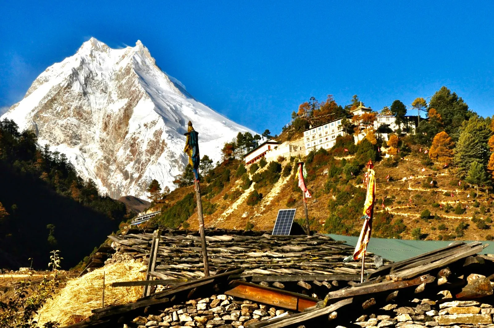
There is a point on the Manaslu Circuit Trek when the journey begins to feel very different from the Nepal you left behind. The road is farther away, the Budhi Gandaki has led you deep between the mountains, and villages begin to carry more signs of the Tibetan Buddhist culture of the upper valley. Ahead, somewhere beyond Samagaun and Samdo, is Larkya La—the high pass that eventually takes the trail over the mountains and down towards Bimthang.
But Manaslu is not a trek that should be reduced to one pass.
The journey follows the Budhi Gandaki, tracing part of an old salt-trade route as it climbs from the lower Himalayan landscape towards the high country near the Tibetan border. Nepal Tourism Board describes the wider Manaslu region as stretching from subtropical Himalayan foothills to arid Trans-Himalayan high pastures, which helps explain why the scenery changes so dramatically during a single circuit. Nepal Tourism Board
Above all of this rises Mount Manaslu (8,163 m), the eighth-highest mountain in the world. Its name is linked to the Sanskrit manasa, commonly interpreted as “Mountain of the Spirit.” Manaslu was first summited in 1956 by a Japanese expedition, after Japanese reconnaissance of the mountain had begun in the early 1950s. Nepal Tourism Board
The first days of the Manaslu trek in Nepal are therefore very different from the last. The trail works its way beside the river, across suspension bridges and through settlements before climbing towards places such as Jagat, Namrung, Samagaun and Samdo. As altitude increases, forests and river gorges gradually give way to a harsher Himalayan landscape, while mani walls, chortens, monasteries and stone-built villages become part of the journey rather than attractions visited separately.
Samagaun is where we deliberately slow the journey down. At this altitude, an acclimatization day is not wasted time. It gives the body more opportunity to adjust before continuing higher, while the surrounding valley offers its own possibilities for exploration. From here the route continues towards Samdo, one of the last major settlements before the approach to Larkya La.
Then comes the part many people picture when searching for the Manaslu Circuit Trek: the crossing of Larkya La at around 5,106 m. It is a long, demanding high-altitude day, but reaching the pass is only half of the story. Instead of turning around and retracing the same valley, the trail crosses the mountain barrier and descends towards Bimthang. That is what gives Manaslu its real sense of a circuit—the landscape on the other side begins another chapter of the walk.
There is also a side of Manaslu that is easy to miss when the conversation focuses only on peaks. The route passes through the Manaslu Conservation Area, part of a central Himalayan landscape where conservation work includes snow leopard habitat and research. NTNC has also confirmed red panda presence within the conservation area, although these animals are elusive and trekkers should never expect a wildlife sighting. National Trust for Nature Conservation
And Manaslu is not “untouched,” despite how often that word appears in trekking advertisements. People have lived, traded, farmed and practised their traditions in these valleys long before trekking became an international industry. For HTV, travelling through Manaslu should therefore mean entering somebody else's home with curiosity and respect—not treating inhabited villages as scenery.
That is also why the Manaslu Circuit appeals to travellers searching for a remote trek in Nepal, a high-pass trek, a cultural Himalayan journey or a quieter alternative to Nepal's busiest trekking corridors. It remains a teahouse trek, but remoteness, consecutive walking days, basic facilities in higher settlements, changing mountain weather and elevations above 5,000 metres make it a challenging trek, not an easy Himalayan holiday.
There is one more reason preparation matters: parts of Manaslu fall within a restricted trekking area. Nepal's Department of Immigration currently lists a separate Gorkha-Manaslu restricted-area permit for Chumnubri Rural Municipality wards 1–4, with season-dependent fees. We handle permit arrangements as part of trip preparation rather than leaving travellers to discover the regulations after arriving in Nepal. Department of Immigration
And conditions here can genuinely change. In September 2026, Nepal Tourism Board reported that a damaged section around Namrung had been restored and an earlier trekking restriction there lifted. That is a useful reminder of what trekking in a living Himalayan landscape actually means: a route description written once should not be treated as permanent. Before departure, current trail, weather and access conditions still need to be checked. Trade Nepal
The 14-day Manaslu Circuit Trek is ultimately for someone who wants the journey between destinations to matter. Mount Manaslu may dominate the skyline and Larkya La may be the physical high point, but the memories are just as likely to come from the sound of the Budhi Gandaki far below the trail, entering another stone village after a long day's walk, watching the landscape become increasingly alpine, or waking up knowing that today's path continues forward rather than turning back.
That is the Manaslu we want to show—not simply a mountain to reach, but a Himalayan journey that changes almost every day you walk through it.