
Know before you go
About Phortse Tenga
Phortse Tenga: A Peaceful Riverside Stop on the Gokyo Lakes Trek
Phortse Tenga is a small riverside trekking settlement at approximately 3,680 metres (12,073 feet) in Nepal's Everest region. Located between Mong La and Dole on the Gokyo Lakes trekking route, it is surrounded by steep mountain slopes, rhododendron forests and the flowing waters of the Dudh Koshi river system.
Unlike the exposed ridge of Mong La or the open alpine landscapes near Gokyo, Phortse Tenga sits in a sheltered valley. The sound of the river, forested surroundings and small mountain teahouses create a different atmosphere from the higher sections of the Everest trekking trails.
For trekkers travelling towards Gokyo Lakes, Phortse Tenga is an important resting point. After descending from Mong La, the trail reaches the river valley before beginning a sustained climb towards Dole.
Although many travellers stop here only for tea or lunch, Phortse Tenga is a memorable part of the journey through Khumbu. Its location offers an opportunity to appreciate the changing landscape, traditional trekking hospitality and natural beauty of the Everest region.
Where Is Phortse Tenga Located?
Phortse Tenga lies in the Khumbu area of Solukhumbu District, Koshi Province, northeastern Nepal, within the wider protected landscape of Sagarmatha National Park.
The settlement is situated below the mountain ridge of Mong La and forms part of the established trekking route towards Gokyo.
The commonly followed route is:
Namche Bazaar → Kyangjuma → Sanasa → Mong La → Phortse Tenga → Dole → Machhermo → Gokyo Village
Phortse Tenga is sometimes confused with Phortse Village, but the two places are different.
Phortse Village is an established Sherpa settlement located higher on the mountainside, while Phortse Tenga is a smaller riverside stop along the Gokyo trekking corridor.
Understanding this distinction is important when planning trekking itineraries, identifying accommodation and following mountain trails.
The Trek from Mong La to Phortse Tenga
The journey to Phortse Tenga usually begins with the climb from Sanasa towards Mong La (approximately 3,975 m).
Mong La is known for its panoramic mountain views, particularly towards Ama Dablam, Thamserku and the surrounding Khumbu peaks.
After reaching the ridge, trekkers begin descending towards Phortse Tenga.
The trail drops through steep mountain terrain, gradually moving from open viewpoints into more sheltered forested slopes.
The descent includes uneven stone steps, rocky paths and sections that may become slippery during rain or freezing weather.
As the elevation decreases, vegetation becomes more prominent and the river valley comes into view.
The walk from Mong La to Phortse Tenga generally takes around 1–1.5 hours, depending on trail conditions, walking pace and rest stops.
The descent can be tiring on the knees, particularly for trekkers carrying heavy backpacks.
Trekking poles and footwear with reliable grip are useful on this section.
The Riverside Landscape of Phortse Tenga
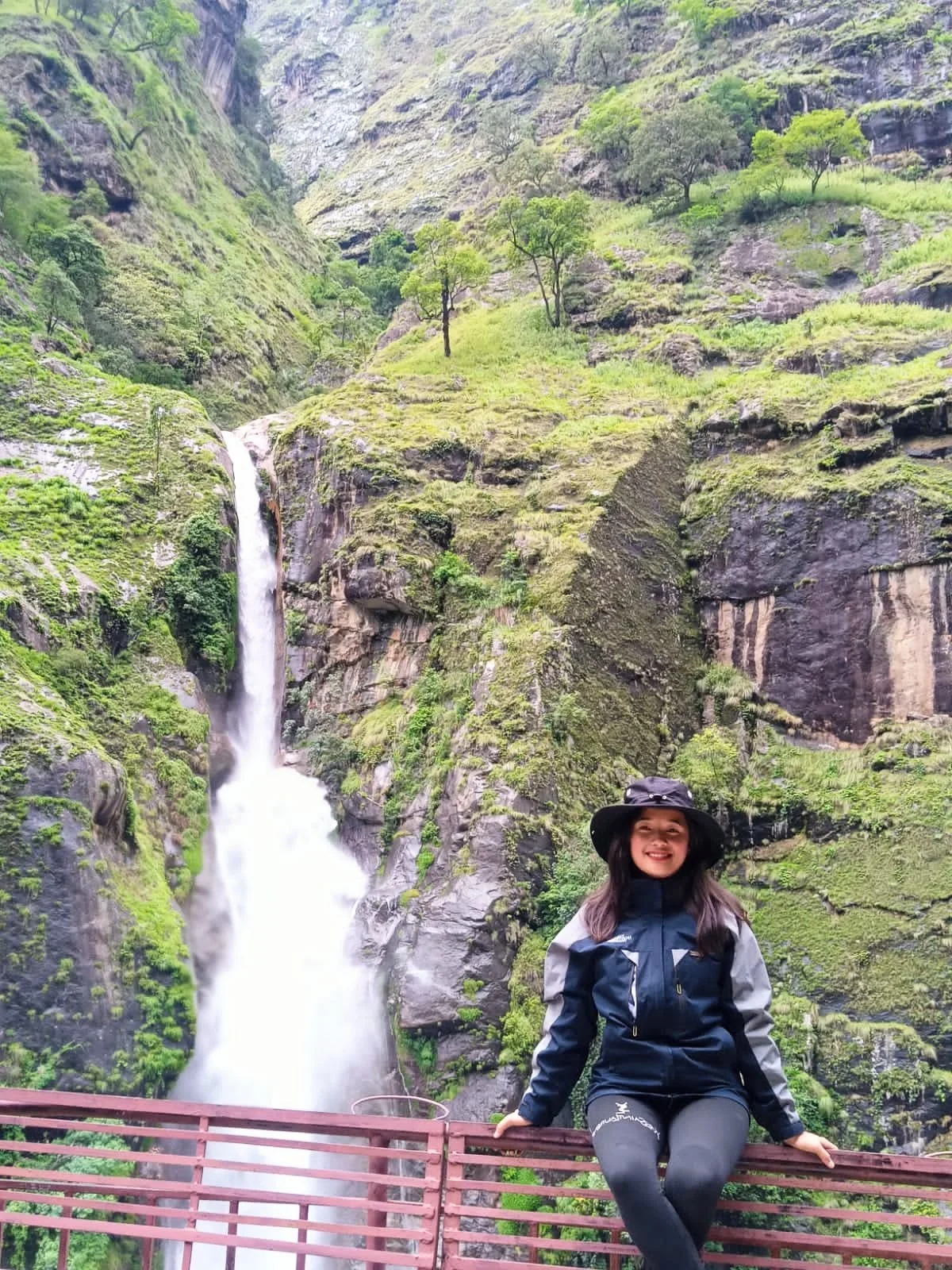
One of the most distinctive features of Phortse Tenga is its location beside a mountain river.
The settlement lies within a narrow valley surrounded by steep forested slopes.
The river forms part of the Dudh Koshi drainage system, which carries water from the high Himalayan valleys towards lower elevations.
The landscape is noticeably different from the exposed ridge above Mong La.
Forested hillsides provide a more sheltered setting, while the river and surrounding mountain terrain create opportunities for photography and short rest stops.
During spring, rhododendrons may flower along suitable forested sections of the surrounding trekking route.
In autumn, clear weather can reveal the steep mountain slopes and valleys with greater visibility.
During the summer monsoon, increased rainfall can make trails muddy and rivers more powerful.
Visitors should remain on established paths and avoid approaching unstable riverbanks or fast-flowing water.
A Resting Point Before the Climb to Dole
Phortse Tenga is particularly important because it sits between two physically demanding sections of the Gokyo trekking route.
Trekkers first climb towards Mong La, descend to the river valley and then begin another ascent towards Dole.
After leaving Phortse Tenga, the trail climbs through forested mountain slopes.
The ascent towards Dole is sustained and can feel challenging because of the altitude and cumulative effort of the trekking day.
Rhododendron, birch and other mountain vegetation may be encountered along suitable sections of the route.
As trekkers gain elevation, the forest gradually gives way to more open mountain terrain.
Dole, situated at approximately 4,000 metres or higher depending on the reference used, is a common overnight destination on the Gokyo Lakes Trek.
The journey from Phortse Tenga to Dole generally requires approximately 2–3 hours of uphill walking, although individual times vary.
Because of the combination of descending and climbing, trekkers should allow enough time to complete the day's route safely.
Teahouses and Local Hospitality
Phortse Tenga has a small number of trekking teahouses that serve travellers moving between Mong La and Dole.
Depending on the season and operating arrangements, visitors may find hot meals, tea, snacks and basic accommodation.
The settlement is much smaller than Namche Bazaar, so facilities and choices are limited.
Many trekkers use Phortse Tenga as a lunch or rest stop rather than an overnight destination.
A warm drink and a short break can be especially welcome before the climb towards Dole.
Common trekking meals may include dal bhat, noodle soup, fried rice, potatoes and other simple dishes.
Food availability and prices depend on the individual teahouse and the supplies available.
Travellers should remember that food, fuel and other goods are transported through difficult mountain terrain, often by porters or pack animals.
Supporting locally operated teahouses helps contribute to the mountain economy.
Phortse Tenga and the Gokyo Lakes Trek
Phortse Tenga is an important early stop on the Gokyo Lakes Trek, one of the most scenic trekking routes in Nepal's Everest region.
After crossing the river valley, trekkers continue towards Dole and then Machhermo.
The landscape changes significantly as the trail climbs higher.
Forested hillsides gradually give way to alpine vegetation, rocky slopes and increasingly open valleys.
Beyond Machhermo, the trail continues towards Gokyo Village and the famous Gokyo Lakes.
The Gokyo region is known for its beautiful glacial lakes, the Ngozumpa Glacier and panoramic Himalayan viewpoints.
One of the most popular attractions is Gokyo Ri (approximately 5,357 m), a high-altitude viewpoint overlooking the lakes and surrounding mountains.
Some longer itineraries connect the Gokyo valley with Everest Base Camp through Cho La Pass.
Phortse Tenga therefore forms part of a trekking corridor leading towards some of the most remarkable landscapes in the Khumbu region.
Phortse Tenga and Phortse Village: Understanding the Difference
Despite their similar names, Phortse Tenga and Phortse Village should not be treated as the same destination.
Phortse Tenga is a small riverside trekking stop on the route between Mong La and Dole.
Phortse Village is a traditional Sherpa settlement situated higher on the mountainside.
Phortse Village is known for its strong mountaineering heritage and traditional community life.
Trekkers travelling through Phortse Tenga do not automatically pass through Phortse Village.
Reaching Phortse Village requires following a different connecting trail.
For travellers interested in exploring traditional Sherpa settlements, Phortse Village may be included in an appropriately planned itinerary.
For those following the standard Gokyo route via Mong La, Phortse Tenga is primarily a rest point before the climb towards Dole.
Sherpa Culture and the Khumbu Region
Phortse Tenga lies within the traditional Sherpa cultural landscape of Khumbu.
For generations, Sherpa communities have adapted to the demanding Himalayan environment through agriculture, livestock keeping, trade and strong community relationships.
Today, trekking and mountaineering are important parts of the regional economy.
Small settlements and teahouses along the Gokyo route help support travellers while providing employment and income for local communities.
Tibetan Buddhism is an important part of Sherpa cultural identity.
Throughout the Everest region, trekkers may encounter prayer flags, chortens, mani walls and other Buddhist religious features.
When passing mani walls or chortens, visitors should follow the customary clockwise direction, keeping the monument on their right.
Respectful behaviour towards local people, religious sites and mountain workers is an essential part of responsible trekking.
Wildlife and Forests Around Phortse Tenga
The forested slopes around Phortse Tenga form part of the wider Himalayan ecosystem protected by Sagarmatha National Park.
The park supports wildlife such as Himalayan tahr, musk deer and several species of mountain birds.
However, wildlife sightings are unpredictable and should never be guaranteed.
Trekkers walking quietly through suitable forested sections may notice birds, animal tracks or signs of local wildlife.
The vegetation also changes with elevation, creating a transition between lower mountain forests and the alpine landscapes found farther north.
Visitors should avoid disturbing animals, feeding wildlife or leaving the established trekking trail.
Photography should be carried out from a safe distance without interfering with natural behaviour.
Best Time to Visit Phortse Tenga
The most popular trekking seasons are spring (March–May) and autumn (September–November).
Spring brings gradually milder daytime temperatures and opportunities to see flowering rhododendrons along forested sections of the route.
Autumn often offers comparatively stable trekking conditions and clear mountain scenery.
During winter (December–February), temperatures can fall below freezing, and shaded trail sections may become icy.
The summer monsoon (June–August) brings increased rainfall, cloud cover and slippery paths.
River levels can also rise during periods of heavy rain.
Weather conditions in the Himalayas can change quickly, so travellers should carry waterproof clothing and warm layers regardless of the season.
Altitude and Acclimatisation
Phortse Tenga is situated at approximately 3,680 metres, making altitude awareness important even though it lies below Mong La.
Trekkers following the Gokyo route usually spend time acclimatising in Namche Bazaar before continuing towards higher elevations.
The descent from Mong La to Phortse Tenga does not eliminate the risk of altitude sickness.
As travellers continue towards Dole, Machhermo and Gokyo, the sleeping altitude increases.
Common symptoms of acute mountain sickness include headache, nausea, dizziness and unusual fatigue.
Trekkers experiencing AMS symptoms should not ascend to a higher sleeping altitude.
Worsening symptoms require descent and medical assessment.
Severe symptoms such as confusion, difficulty walking normally or breathlessness at rest require urgent action.
A carefully planned itinerary with gradual altitude gain is essential for safer trekking.
Responsible Trekking in Phortse Tenga
Phortse Tenga lies within the protected environment of Sagarmatha National Park, a UNESCO World Heritage Site.
The rivers, forests and mountain slopes surrounding the settlement are sensitive to increasing tourism pressure.
Visitors should carry rubbish to suitable disposal facilities and avoid leaving plastic bottles, food wrappers or other waste along the trail.
Use a reusable water bottle and appropriate water purification methods.
Stay on established paths to reduce erosion and vegetation damage.
Avoid washing with soap directly in rivers or streams.
Do not disturb wildlife or remove plants.
Respect local teahouses, guides, porters and pack-animal handlers.
Responsible trekking helps preserve the environment and supports the communities that maintain the region's trekking routes.
Why Visit Phortse Tenga?
Phortse Tenga is worth visiting for its peaceful riverside setting, forested Himalayan landscape and important position on the Gokyo trekking route.
It offers a welcome contrast to the exposed mountain ridge of Mong La.
The river valley provides a natural place to rest before the sustained climb towards Dole.
For trekkers interested in Himalayan landscapes, Phortse Tenga illustrates how quickly the environment can change within a single trekking day.
For those travelling towards Gokyo Lakes, it is an important geographical landmark connecting the lower Khumbu trails with the higher valleys.
Although it is not a major sightseeing destination, its location and natural surroundings make it a memorable part of the journey.
Explore Phortse Tenga with Himalayan Trek Ventures
At Himalayan Trek Ventures, we believe that the smaller places along a trekking route are just as important to understanding the journey as the famous destinations.
Phortse Tenga is one of those places.
After descending from Mong La, trekkers reach a peaceful river valley surrounded by mountain forests before beginning the climb towards Dole.
This change in landscape is part of what makes the Gokyo Lakes Trek so rewarding.
Our Gokyo trekking itineraries can follow the route through Mong La and Phortse Tenga, allowing travellers to experience the changing scenery of the Everest region while following a suitable acclimatisation plan.
Whether you are heading towards Gokyo Lakes, Gokyo Ri or a longer Everest Three Passes adventure, Phortse Tenga offers a refreshing pause in the journey.
Phortse Tenga is a small but memorable riverside stop where the forests, rivers and mountain trails of Khumbu come together on the way to Gokyo Lakes.